|
| RockWorks - Graphic Output |
 |
| |
| RockPlot2D |
 |
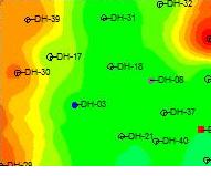
Use this interactive window to view and edit your RockWorks 2D images – borehole and sample location point maps, contours and colorfill maps, cross-sections, profiles and other diagrams such as stereonets and piper diagrams. |
|
| |
| RockPlot3D OpenGL viewer |
 |
use the RockPlot3D OpenGL viewer to view 3D images: solids, surfaces, fences, 3D objects, plan view maps, site diagrams and much more! |
|
| |
| ReportWorks |
 |
Use the ReportWorks window to lay out pages for printing and publication- use any of the images that you've created in your final presentation. |
|
| |
|
|
|
|
| Helping Communities |
|
Project Review
Ecoseal reviewed the ACIAR Project on Sustainable Agriculture in Saline Environments through Serial Biological Concentration, which was carried out in Pakistan and Australia. |
|
| Read More |
|
Seawater Intrusion Model for the Island of Kayts, Sri Lanka
Assessing sustainable water supply options for Kayts to limit the impact of saline groundwater upconing and saltwater intrusion along the northwest coast of Sri Lanka. |
| Read More |
|
Groundwater Management Model for the Lower Murray, Australia
The aim of this project was to develop a groundwater management model which was used by natural resource managers and the community to better manage the groundwater resources of the Lower Murray. This region has been designated as a potential high-risk aquifer system.
|
| Read More |
|