|
| RockWorks - Volumetrics and Pit Optimization |
 |
| RockWorks offers both interactive viewing of volume computations, as well as detailed reports. |
| |
| Use RockWorks to create on-the-fly and report-based volume computations from a variety of model types: |
| |
| Lithology Models |
- View the volume of each lithology type right in the 3D window
- Create a detailed report of the volume of each lithology type, at user-specified intervals. The report can also list percent of material, numbers of nodes, and mass.
|

Volumetrics report for a lithology model |
|
| Stratigraphy Models |
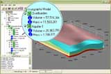
- View the volume of each formation right in the 3D viewer
- Create a detailed report of the volume of each stratigraphic layer, at user-specified intervals. The report can also list percent of material, numbers of nodes, and mass
|

Volumetrics report for a stratigraphy model |
|
| Quantitative Models |
- Display interpolated stratigraphic surfaces in fence panels, or display "straight" linear correlations
- Include a stratigraphy color legend
- Turn individual layers on and off
- Stratigraphic fences can be created in Shapefile format for display in ArcScene®
|

Volumetrics report for a geochemistry model of arsenic concentrations in soil |
|
| Surface Based Volumetrics |
Use tools in the RockWorks Utilities to create:
- Grid-statistics reports for isopach grids include volume
- Easy Stockpile volumes based on X, Y and thickness spreadsheet
- Grid-Based Volume Report incorporating filters based on thickness, boundary polygon and distance to data points
|
|
| Advanced Volumetrics Tools |
- The RockPlot3D viewer includes tools for quick model filtering and volume calculation
- Excavation and overburden modeling
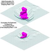
- Pit generation and optimization based on boundary polygon, slope and bench specifications, maximum excavation depth and stripping ratio
|

Solid Model Volumetrics |
| |
| |
|