|
| Didger - Digitizing Options |
 |
| |
The process of creating new digital information often starts with a paper map, graph or log, or a digital image such as an aerial photo, satellite imagery or scanned paper map. Didger provides an easy and complete solution to digitize vector data from your source documents and files by using a powerful set of manual and automatic tools. You can digitize text, points, polylines, polygons, rectangles, circles, spline areas, spline polylines, and wrapped polylines. Didger supports four ways to digitize information:
1. Full Automatic Digitizing! Didger supports advanced raster to vector conversion for automated map digitizing! This means that one command will automatically convert your scanned map, image, or drawing to vector formats quickly and at high quality. This eliminates the need for slow and inaccurate manual digitizing of detailed lines – let Didger do it for you! The lines and polygons are extracted and displayed right on top of the image for you to verify and edit. Didger also boasts a full line of preprocessing options for finer control over the vectorization process so you can get the best possible results! |
| |
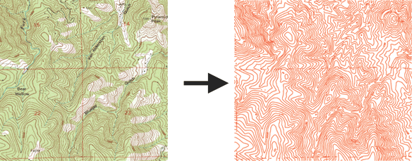
A georeferenced USGS Digital Raster Graphic was imported into Didger 4 (left). The contour lines were detected and automatically vectorized to red polylines (right).
|
| |
| 2. Manual Onscreen Digitizing! You can perform onscreen digitizing using an imported vector file or imported image file. Performing heads-up digitizing has never been easier. You simply draw the object on the screen using your mouse. You can zoom in and out, or pan the screen while digitizing so you can always see clearly what you want to digitize. |
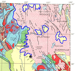
In this example, the boundary of the Modoc Plateau in Northern California being digitized in blue from a calibrated raster image of the geology of California. |
| |
| 2. Manual Onscreen Digitizing! You can perform onscreen digitizing using an imported vector file or imported image file. Performing heads-up digitizing has never been easier. You simply draw the object on the screen using your mouse. You can zoom in and out, or pan the screen while digitizing so you can always see clearly what you want to digitize. |
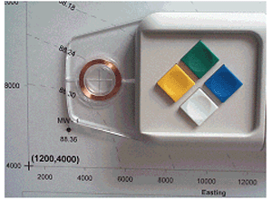
You can digitize paper documents with a digitizing tablet and a puck or stylus. |
| |
| 4. GPS Digitizing! Any NMEA compatible GPS device connected to your computer's serial port can be used as a digitizing device in Didger. Once the GPS is set up to communicate with Didger, you can begin digitizing over any map. Use the GPS for a "moving map" effect to automatically move the map as you travel. You can use your GPS unit to digitize your position, well locations, fence lines, roads, streams, drainage lines, tree lines, crop boundaries, sample locations, trails, or track your route real-time directly onto your map! |
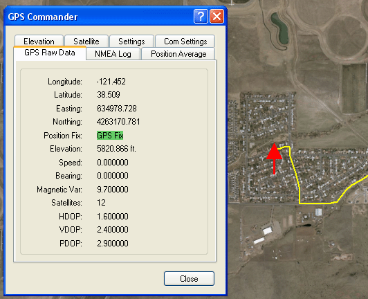
Digitize points, polylines, and polygons with your GPS unit! View your current elevation, see the current position of the satellites that are being used for a lock, display the raw data being sent from the GPS, and set the GPS input datum in the GPS Commander dialog box. |
| |
|
|
|
|
| Helping Communities |
|
Project Review
Ecoseal reviewed the ACIAR Project on Sustainable Agriculture in Saline Environments through Serial Biological Concentration, which was carried out in Pakistan and Australia. |
|
| Read More |
|
Seawater Intrusion Model for the Island of Kayts, Sri Lanka
Assessing sustainable water supply options for Kayts to limit the impact of saline groundwater upconing and saltwater intrusion along the northwest coast of Sri Lanka. |
| Read More |
|
Groundwater Management Model for the Lower Murray, Australia
The aim of this project was to develop a groundwater management model which was used by natural resource managers and the community to better manage the groundwater resources of the Lower Murray. This region has been designated as a potential high-risk aquifer system.
|
| Read More |
|


