|
| Didger - Versatility |
 |
| |
Compatibility! Didger 4 is tremendously flexible. Didger supports over 40 import file formats and exports in over 25 file formats to make sure you can import and export your data in the formats you need. Create large coverages easily by importing several vector, data, or image files into one project. The files will align according to their coordinate systems. Import or export multi-line LAS files, export as a PDF file, or export as an HTM file with working hyperlinks to publish your maps on the web for browsing by anyone.
Object Editing! We know creating and editing data is very important to you, so we have made every effort to make it as easy and efficient as possible! Change color, line styles, fill patterns, symbol size, and font properties with just a few clicks. Polylines can be created, moved, joined, resampled, split, removed, trimmed, colored, and labeled. Closed polygons are formed easily from existing polylines with the polygon editing tools. Convert points to polylines, polylines to polygons, and vice versa. Each object has its own invisibility control, so you can create any type of map, showing only the data you want without actually removing data from your project. You can also assure you have all the information you need by creating up to 256 identification attributes per object!
Layers! Keep your project organized by importing and creating data for different themes onto different layers! Didger's Layer Manager makes managing the layers easy - including moving objects between layers, renaming the layer, turning the layer on or off, and locking the layer so that you cannot accidentally edit or move items on that layer. Data editing and handling is easier than ever! |
| |
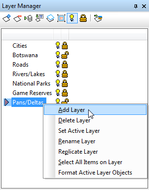
Organize your data easily by separating components onto different layers. The Layer Manager makes accessing and editing layer properties easy! |
| |
| |
|
|
|
|
| Helping Communities |
|
Project Review
Ecoseal reviewed the ACIAR Project on Sustainable Agriculture in Saline Environments through Serial Biological Concentration, which was carried out in Pakistan and Australia. |
|
| Read More |
|
Seawater Intrusion Model for the Island of Kayts, Sri Lanka
Assessing sustainable water supply options for Kayts to limit the impact of saline groundwater upconing and saltwater intrusion along the northwest coast of Sri Lanka. |
| Read More |
|
Groundwater Management Model for the Lower Murray, Australia
The aim of this project was to develop a groundwater management model which was used by natural resource managers and the community to better manage the groundwater resources of the Lower Murray. This region has been designated as a potential high-risk aquifer system.
|
| Read More |
|


