Ecoseal Developments Pvt Ltd
FEFLOW Create publication quality 2D or 3D graphs quickly and easily.
 
Overview

Feflow is one of the most outstanding software packages for the simulation of flow and mass and/or heat transport processes in saturated and unsaturated porous media.

 
Main Features
 
 
Feflow has the highest scientific standard available today with extensive modeling possibilities:

  • unsaturated and saturated conditions
  • flow, mass and/or heat transport modeling
  • density dependent modeling
  • sorption and reaction processes
  • 1D/2D discrete feature elements for modeling fractures, channels, tubes, etc.
 
  • Feflow allows you to work comfortably with self explanatory handling and graphical user interfaces.
  • It has numerous import functions for model parameters and background maps.
  • It includes semi-automatic assignment of model parameters based on background maps
  • It can create built-in regionalization functions for all parameters
  • Feflow is an interface to ArcGIS, ArcView and ArcInfo
  • Feflow uses sophisticated numerical algorithms for the solution of extensive modeling tasks and integrated tools to analyze and visualize the results of modeling
  • It includes extensive export functions for data as well as 2d and 3d views in numerous different file formats for isoline maps, particle tracking, and isosurfaces.
 
Back To Top
 
 
Helping Communities
Project Review

Ecoseal reviewed the ACIAR Project on Sustainable Agriculture in Saline Environments through Serial Biological Concentration, which was carried out in Pakistan and Australia.
Read More
Seawater Intrusion Model for the Island of Kayts, Sri Lanka

Assessing sustainable water supply options for Kayts to limit the impact of saline groundwater upconing and saltwater intrusion along the northwest coast of Sri Lanka.
Read More
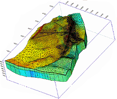
Groundwater Management Model for the Lower Murray, Australia

The aim of this project was to develop a groundwater management model which was used by natural resource managers and the community to better manage the groundwater resources of the Lower Murray. This region has been designated as a potential high-risk aquifer system.
Read More
Designed By: www.vergesystems.com