|
| RockWorks - in the geotechnical industry |
 |
| RockWorks is a great tool for geotechnical and civil engineers to use when evaluating construction and excavation sites. Whether you're in the beginning, middle or ending phase of a project, you'll find that RockWorks will save you and your clients both time and money. |
| |
| RockWorks features applicable to the geotechnical industry |
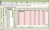
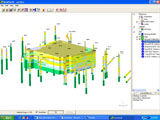
- The Borehole Manager allows you to bring soil boring, sampling, well screening and other information into the program via a simple Excel or ASCII file import.
|
 |
|
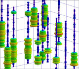
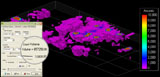
- View your downhole sampling information in 2D and 3D using a variety of methods and color schemes.
|
 |
|
 |
|
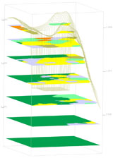
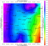
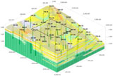
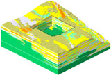
- Create 2D and 3D contour maps of stratigraphic surfaces and isopachs. A variety of gridding methods are available.
|
Solid Model Volumetrics |
|
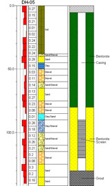
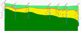
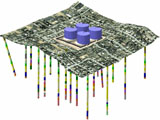
- Create sections showing modeled lithology and stratigraphy.
|
 |
|
|
|
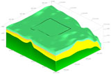
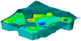
- Generate solid models and volumetric estimations of stratigraphy, lithology, and other downhole parameters.
|
 |
|
 |
|
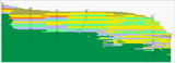
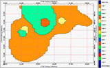
- Create maps showing lithology and stratigraphy at different levels..
|
Solid Model Volumetrics |
|
- Estimate extraction volumetrics based on your solid models.
- Easily import LogPlot data.
|
Solid Model Volumetrics |
|
|
|
- Easily estimate excavation volumetrics.
|
 |
|
- Easily import LogPlot data.
|
|
|
- Float or drape airphotos over your 3D logs, solids, and surfaces.
|
 |
| |
|