|
| Surfer - Variograms |
 |
| |
| Use the variogram modeling subsystem to quantitatively assess the spatial continuity of data. Variograms may be used to select an appropriate variogram model when gridding with the Kriging algorithm. Surfer uses a variogram grid as a fundamental internal data representation and once this grid is built, any experimental variogram can be computed instantaneously. |
| |
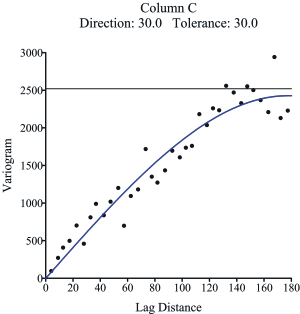
Instantly create variograms in Surfer to quantitatively assess the spatial continuity of your data. |
| |
| Variogram Features |
- Virtually unlimited data set sizes
- Display both the experimental variogram and the variogram model
- Specify the estimator type: variogram, standardized variogram, auto covariance, or auto correlation
- Specify the variogram model components: exponential, Gaussian, linear, logarithmic, nugget effect, power, quadratic, rational quadratic, spherical, wave, pentaspherical, and cubic models
- Customize the variogram to display symbols, variance, and number of pairs for each lag
- Export the experimental variogram data
|
| |
|
|
|
|
| Helping Communities |
|
Project Review
Ecoseal reviewed the ACIAR Project on Sustainable Agriculture in Saline Environments through Serial Biological Concentration, which was carried out in Pakistan and Australia. |
|
| Read More |
|
Seawater Intrusion Model for the Island of Kayts, Sri Lanka
Assessing sustainable water supply options for Kayts to limit the impact of saline groundwater upconing and saltwater intrusion along the northwest coast of Sri Lanka. |
| Read More |
|
Groundwater Management Model for the Lower Murray, Australia
The aim of this project was to develop a groundwater management model which was used by natural resource managers and the community to better manage the groundwater resources of the Lower Murray. This region has been designated as a potential high-risk aquifer system.
|
| Read More |
|


