|
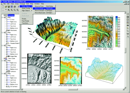
| Surfer |
 |
| A Powerful Contouring, Gridding, and Surface Mapping Package for Scientists and Engineers |
| |
| Surfer is a contouring and 3D surface mapping program that runs under Microsoft Windows. It quickly and easily converts your data into outstanding contour, surface, wireframe, vector, image, shaded relief, and post maps. Virtually all aspects of your maps can be customized to produce exactly the presentation you want. Producing publication quality maps has never been quicker or easier. |
| |
 |
| |
| Features: |
|
| |
| |
|
|
|
|
| Helping Communities |
|
Project Review
Ecoseal reviewed the ACIAR Project on Sustainable Agriculture in Saline Environments through Serial Biological Concentration, which was carried out in Pakistan and Australia. |
|
| Read More |
|
Seawater Intrusion Model for the Island of Kayts, Sri Lanka
Assessing sustainable water supply options for Kayts to limit the impact of saline groundwater upconing and saltwater intrusion along the northwest coast of Sri Lanka. |
| Read More |
|
Groundwater Management Model for the Lower Murray, Australia
The aim of this project was to develop a groundwater management model which was used by natural resource managers and the community to better manage the groundwater resources of the Lower Murray. This region has been designated as a potential high-risk aquifer system.
|
| Read More |
|


